Process
In this technical skills lesson the steps to create all map items will be explored individually, additional appropriate items beyond the scope of this lesson can be added to the final map. Care is required to insure that enough information is placed on the map to explain the purpose, but not so much data to confuse the viewer or shrinking the map size. Reports are always important to accompany maps to explain the purpose and the conclusions of the research.
Page and Print
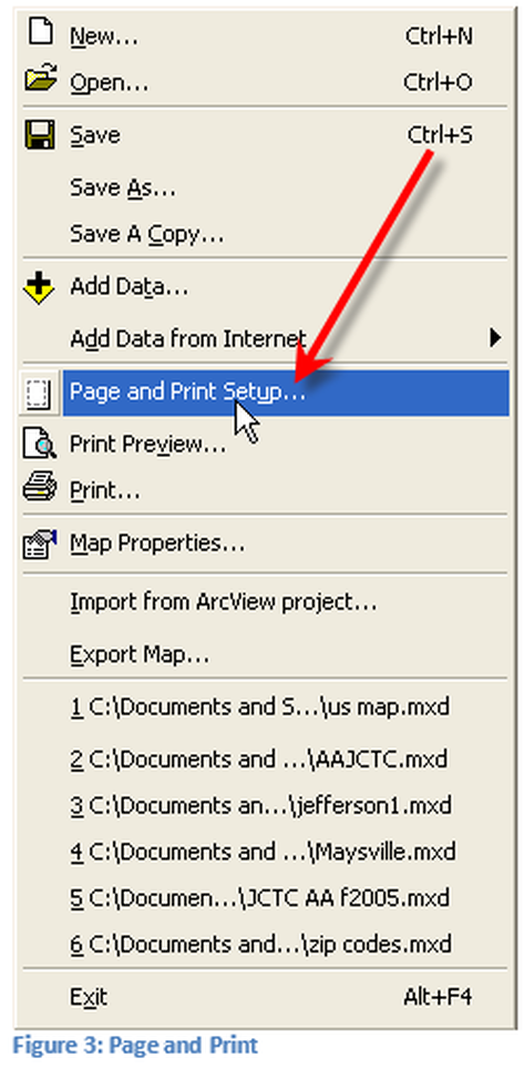
The first step for publishing the map is the Page and Print Setup, which is located in the file menu, see Figure 3. Setting up the page dimensions, before creating the items required for the static map is critically important. If the page is not set-up initially and done later the items added to the map will not be in the correct location and will need to be manually moved.
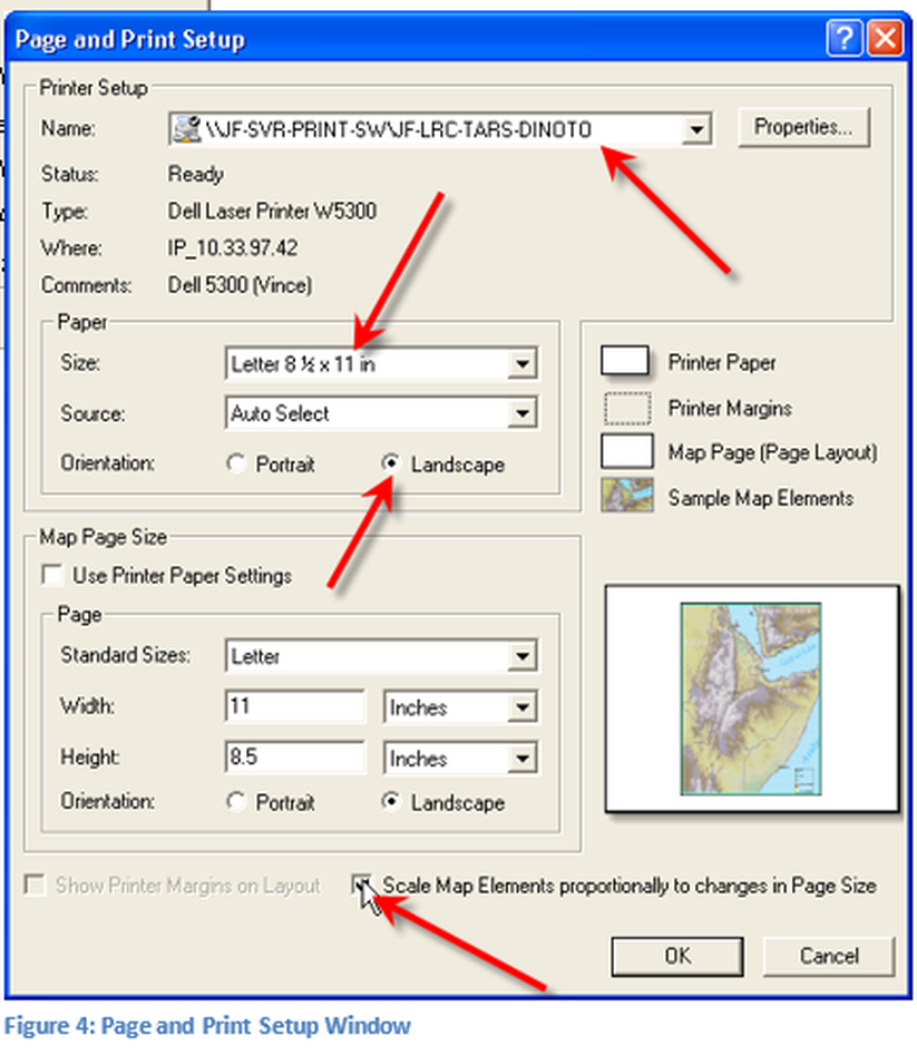
A new window will open for the Page and Print Setup, as shown in figure 4. The four arrows point to items that will be discussed.
First select the printer in which the map will be outputted to, additional printer properties may also need to be changed (Properties Button), for example if the printer can support Super B format paper, but the default for the printer is A sized paper, adjust this property (next arrow down). If the output of the map is a large scale printer/plotter this will need to be adjusted appropriately by adjust the printer/plotter properties. While these adjustments are important in displaying the map, they are more of an operating system process than a mapping process. The display may look slightly different depending upon selected parameters.
Next select the size of the paper for the map and the orientation of the paper. For this example a Dell Laser Printer using standard letter size paper was used. The orientation of the paper is to be set to landscape due to the shape of the map chosen. Make sure to check Scale Map Elements proportionally to changes in Page Size, if this is not checked a skewed map will be produced. Click OK to close the window.
These parameters can be changed later if the map is to be printed to a different device or at a different size this is accomplished by returning to the same window and making the appropriate adjustments to the map. If adjustments are made after doing a layout make sure the placement and the sizing of the items are appropriate.
Layout View
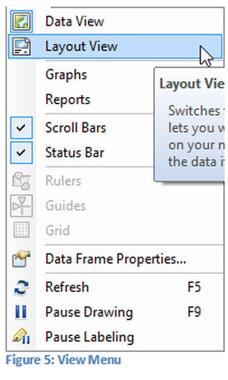
Normally when working on maps Data View is the mode that is used, it is the default on a new map. When creating a final map switch to the Layout View. To change the View of the map select the View Menu and select Layout View from the pull down menu as seen in figure 5. In the layout view items such as legends, titles, scales, directional, arrow, etc. can be added.
The black line around entire map in Figure 6: Fitting Map to Page represents the size of the paper any item outside this boundary may not be projected appropriately. The inner box with the six handles (small boxes) represents the size of the map. The map should be stretched, using the handles, to fill most of the page, it will be sized proportionately so that the aspects of the map remain true.
The black line around entire map in Figure 6: Fitting Map to Page represents the size of the paper any item outside this boundary may not be projected appropriately. The inner box with the six handles (small boxes) represents the size of the map. The map should be stretched, using the handles, to fill most of the page, it will be sized proportionately so that the aspects of the map remain true.
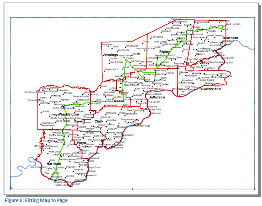
After the map has been stretched it will fill most of the page, note that the aspect ratio of the map has not changed. This was done in Figure 6 prior to taking a screen capture of the map. At the top of the map is an area that has been left blank, which will be the location for the map title.
Title
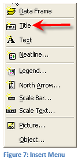
The first item to add to the map is a Title. Click on the Insert Menu and select Title. ArcGis for Desktop must be in Layout View for this feature to be available, if in data view these items are not available.
The title box will be placed on the map in the upper center. Begin typing the descriptive title, the box can be moved to any location on the map. Initially don’t be concerned with the font size, type and color all of which can be modified.
The title box will be placed on the map in the upper center. Begin typing the descriptive title, the box can be moved to any location on the map. Initially don’t be concerned with the font size, type and color all of which can be modified.
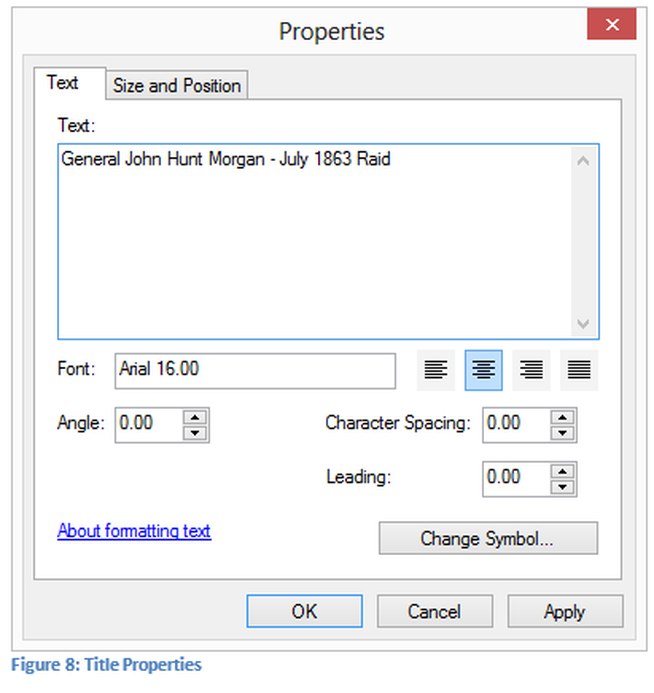
Double Click on the title to open the title properties window seen in Figure 8. Note a title for the map has been created. Multiple parameters can be changed such as the size, position, symbol, and centering of the title, much like a word processor. Make as many changes as appropriate for the title. Click OK when the modifications are completed to the title.
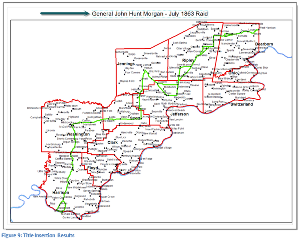
The results can be seen in Figure 9, note the title at the top of the map.