Geocoding - Changing Addresses to Coordinates
|
Click here to download the data that the author used for the course lesson. By downloading the data you will be able to follow the steps completely.
|

|
Prerequisites
It is assumed that the user is experienced working with Microsoft Excel spreadsheets and has created maps with ArcMap Desktop prior to beginning this module.
Concept
Geocoding is the process of taking a data file such as a Microsoft Excel spreadsheet or a CSV (comma delimited text file) containing street address data (address, city, state, zip code) and giving the street address data a geospatial coordinate position. This module will examine batch coding of addresses. For example, Google Maps is used to determine the location of a business, the user inputs the address and the map shows the position of the business. Google Maps does not store the location of every address in the world but instead uses a geocoding process to locate the business on a map. The geocoding process that will be discussed in this module will use an Excel spreadsheet for a group of bulk addresses. The geocoding process will create a point shapefile which contains all the information from the spreadsheet as well as the x and y coordinates.
Geocoding is the process of positioning an address by using a locator file, which contains address information for a range of addresses. In this exercise the locator file will be located on a geospatial server. Since all the data will be from the United States the locator file will be only for the U.S. and not one for the entire world. Any address outside of the U.S. will be returned un-coded. The locator file uses road segments broken into blocks to locate an address as well as knowing the side of the street for even and odd numbered addresses. This module will deal with the management of the data to be coded
The geocoding process in ArcMap for Desktop can be accomplish in more than one way. This module will discuss only one methodology for the geocoding of data.
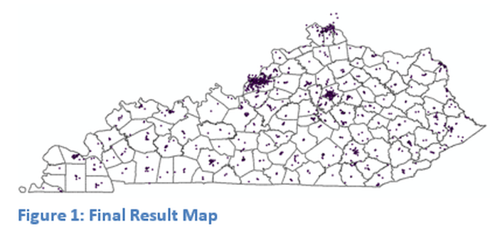
When the process of Geocoding is completed the results should have a similar appearance to the map in Figure 1: Final Result Map.
A basemap from an ArcGIS Server will be available for use as well as a Microsoft Excel data file for download. The user may select address data of their choice contained within a spreadsheet or CSV file. The basemap selected can be a service or a self-generated map. For assistance in working with server based data review the ArcCatalog module. The Excel data file supplied will be for Kentucky doctors, if a different spreadsheet is used it must contain complete addresses and at least 50 records. Insure that appropriate geography is loaded onto the map.
A basemap from an ArcGIS Server will be available for use as well as a Microsoft Excel data file for download. The user may select address data of their choice contained within a spreadsheet or CSV file. The basemap selected can be a service or a self-generated map. For assistance in working with server based data review the ArcCatalog module. The Excel data file supplied will be for Kentucky doctors, if a different spreadsheet is used it must contain complete addresses and at least 50 records. Insure that appropriate geography is loaded onto the map.

