Adding a Server Basemap
In general, base maps are stored on the Internet and not on a local machine, the server can be within the organization and not a public facing device. A basemap can be a static map or a dynamic map layer that is added to a user’s map in which there no control over the editing or appearance of the content. In general, this is done so items such as road files, cities, rivers need not be added and the user only adds their data. This type of information can be a raster images or can be vector cached image, such as Open Street Map Basemaps can come from many different sources and added in multiple ways.
Basemaps
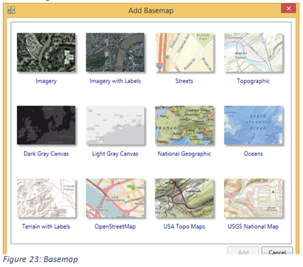
Within Esri ArcMap, next to the Add Data Button is a pull down arrow, from that location a user can select Add Basemap as well as connecting to ArcGIS Online. If the Add Basemap is selected the user has the choice of nine predefined basemaps. When one of these maps is selected the map is generally placed at the lowest level and the editor places data above this layer. The author favors Open Street Map since the base layer can be edited.
|
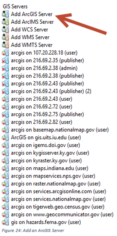
Connecting to a Geospatial ServerA geospatial server can stream information to the user to be used within a map project. The data streams can be either a non-editable or editable creation, the editing of these services will be covered in other courses. For this lesson only connections to non-editable data will be discussed. The user will have no control over how the information appears. The information may be used to provide boundaries, such as a county boundary, streams and road locations. Therefore, the user of the data from the geoserver can select the layers used, but not need to search for appropriate shapefiles. In the discussion of basemaps the images, in general, are not transparent and therefore must be the lowest level the same is not true for geospatial server services. Before a service can be used a connection must be established to the server, no login information is required if the service is an open service. This connection can be made in either ArcCatlog or ArcMap, for this example the connection will be made in ArcCatalog. Open ArcCatalog and move below the folder location to the position where a GIS Server can be added, see
figure 24. |
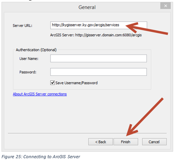
The server will be an ArcGIS Server, which is the first item in the list. Below the first five items in the list are the connections that have been made to geospatial servers, on the authors computer, some are internal at Jefferson Community and Technical College and some are at other organizations. A list of some of the servers used by the author can be found at: http://vincedinoto.wixsite.com/geospatial/data . Click on add ArcGIS Server, select the first radio button, use GIS Services and click Next. In the next window, see Figure 25, a connection location is entered (potential servers are those in the hyperlink above or http://216.69.2.35/arcgis/services, http://216.69.2.38/arcgis/services or http://216.69.2.43/arcgis/services). Once the connection is established the server should appear in the list. At this point open the server by double clicking on the name and services available will be visible. There might be a slight delay in the operation as compared to a desktop loading since it is utilizing an Internet based service.

