Adding Data
There are three different ways in which a shapefile can be added to a map; utilize ArcCatalog, the Add Data Button in ArcMap or Microsoft Windows Explorer. Using Windows Explorer is not the recommended way to add data to a map. The simplest and most straight forward method is the utilization of the Add Data Button.
The Add Data Button and ArcCatalog provides the ability to connect to resources such as geodatabases or geospatial services as well as relational databases, which cannot be accomplished through Windows explorer.
When a shapefile is added from the methods noted above, all folder files are not visible, only those which can be added to a map. In ArcMap and ArcCatalog to access a folder a path must be established, similar to the mapping of a network drive, this includes shapefiles in a folder or geodatabase. To map a folder the user must use the icon of a folder with a plus sign. Mapping to individual files is not done only at the folder level. Once the mapping to file a folder location is established, it will remain mapped during the current and future projects even when the software has been stopped and reloaded. Care should be taken to the depth level of the path, for example, if all data is stored in a folder with only one level of sub-folders, map to the master folder.

The Add Data Button on the toolbar in ArcMap gives a very straightforward way of adding data, but does not give any additional control. It opens an explorer type window, note the symbols from the two geodatabases, data from server sources can also be added, as seen in figure 31.
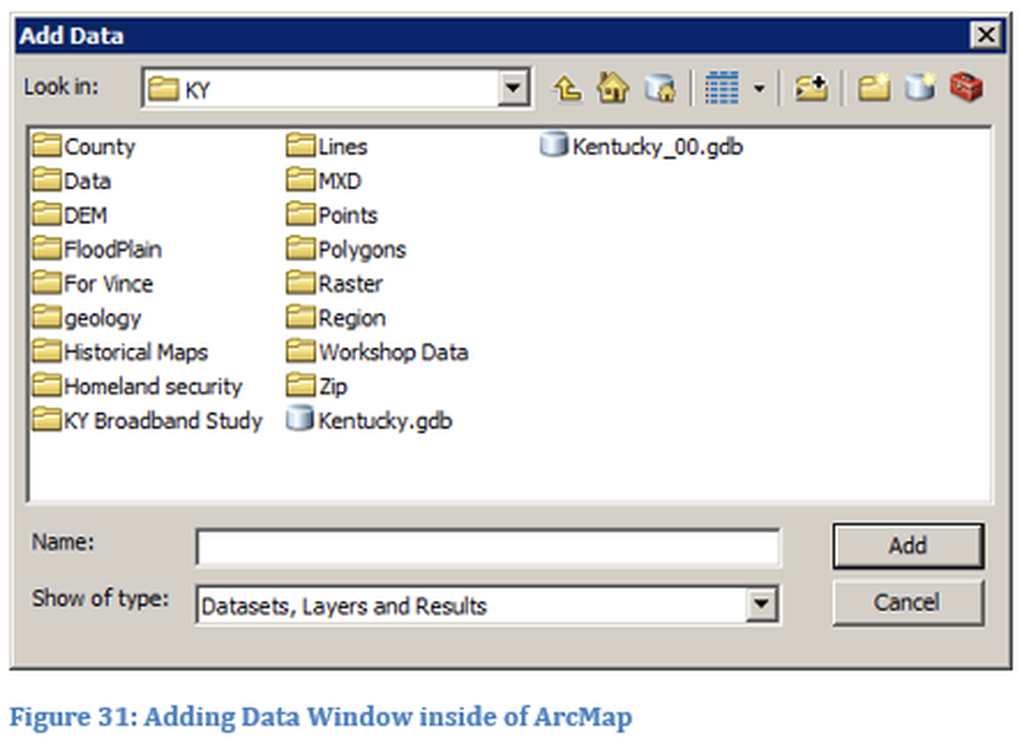
If the KY folder was viewed in Windows Explorer the two geodatabases would appear as folders.
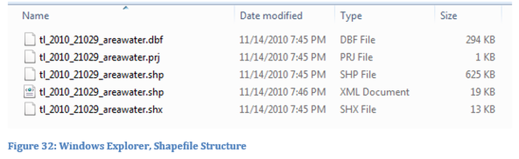
A single shapefile uses other files for proper operation. When a shapefile folder is viewed in Windows Explorer, all the different file types are visible, each file has the same name, but different extensions. The file that is loaded into ArcMap is the file with the shp extension. All the files in the folder must remain in the same folder for proper operation. If the same folder was viewed in ArcCatalog only a single file would be visible. Depending on the shapefile, there may be a different number of files contained within the folder. For example, if the shapefile has a projection then there will be a file with a prj extension, if the file has metadata then there is a file with an xml extension. There will always be certain files within the folder such as the dbf file which contains the data for the shapefile. These individual component files cannot be identified in a personal geodatabase, due to how the database displays information.
Layer File and Layer Package
A layer file is composed of a shapefile and the properties that are set within the layer property window. The properties window can be accessed by right clicking on the file name. A layer file is different than the referencing of a layer in the Table Contents. In the layer property window the user can modify symbology, query information, labeling, etc. When a a map is created with a specific shapefile the user modifies the properties of the shapefile, but this information is saved in the project file not with the shapefile. Thus when the shapefile is loaded into another project, none of the properties have been retained from the previous project and must be reconfigured. For example, the user has set the color and width of lines representing a river to blue and 2 pts in width, this information is not retained in the shapefile. If the user instead creates a layer file which is associated with specific shapefiles, the layer file retains the properties. The pathway to the shapefile stored in the layer file must be maintained and not changed, if the pathway is changed the layer file will become disassociated from the shapefile. The layer file is similar to how the project file functions, it creates a path to the shapefile but does not contain the shapefile information.
A layer package is similar to a map package, but instead it contains information only about one or more layers. By using the layer package property information including symbology can be transported to different users and thus not requiring a reassignment of properties. More than one layer file can be contained within a single layer package. It is recommended that only layers that are associated be put into a layer package since the package might become so large it slows the transfer of information. For example, an appropriate layer package might include: a layer of state boundaries, layer of state level county boundaries, layer of state streams and layer of state roads. An example of a bad package would be a layer of Jefferson County census tracts and a layer of national roads.
A layer package is similar to a map package, but instead it contains information only about one or more layers. By using the layer package property information including symbology can be transported to different users and thus not requiring a reassignment of properties. More than one layer file can be contained within a single layer package. It is recommended that only layers that are associated be put into a layer package since the package might become so large it slows the transfer of information. For example, an appropriate layer package might include: a layer of state boundaries, layer of state level county boundaries, layer of state streams and layer of state roads. An example of a bad package would be a layer of Jefferson County census tracts and a layer of national roads.

