Geographic Coordinates
An understanding of coordinate systems is essential for locating objects on the surface of the earth and thus on a map. Just as in mathematics, when locating points on a graph an x and y coordinate system is used, a similar method is used in mapping. You may already be familiar with the latitude and longitude system. Lines of latitude run parallel to the equator and are measured from 0 to 90 degrees north of the equator and 0 to 90 degrees south of the equator. Lines of longitude run perpendicular to the lines of latitude, they run from pole to pole. They are measured from 0 to 180 degrees east and 0 to 180 degrees west of the prime meridian. The prime meridian is the line of zero longitude.
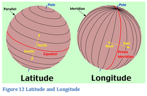
This system is very efficient, it works with angular measurements so a degree is composed of 60 minutes of arc and one minute of arc is 60 seconds of arc. Fractional parts of a second of arc are calculated as a decimal number. A line of longitude might be listed as 87 degrees 24 minute 36.8 seconds west. A more modern way of working with arc measurements is to utilize decimal degrees like 87.34873 degrees west. Decimal degrees make for simpler numerical calculations. Decimal degrees do not use the minutes and seconds measurement. A direction must always be used with a measurement of latitude or longitude, for computing purposes plus and minus signs are used. Latitude north is a positive number and south a negative number, for longitude west is negative and east is positive. Most geospatial software can use either angular measurement or decimal degrees.
There are other systems with different units such as feet and meters. When data has different coordinate systems it effects how the data is displayed. It is critically important that when data is imported into a map that it has the same geographical projection as well as the same coordinate systems so that it will be displayed correctly. ArcMap will attempt to place the data appropriately onto an existing map if there is a defined coordinate system and projection.
There are other systems with different units such as feet and meters. When data has different coordinate systems it effects how the data is displayed. It is critically important that when data is imported into a map that it has the same geographical projection as well as the same coordinate systems so that it will be displayed correctly. ArcMap will attempt to place the data appropriately onto an existing map if there is a defined coordinate system and projection.
State Plane |
|
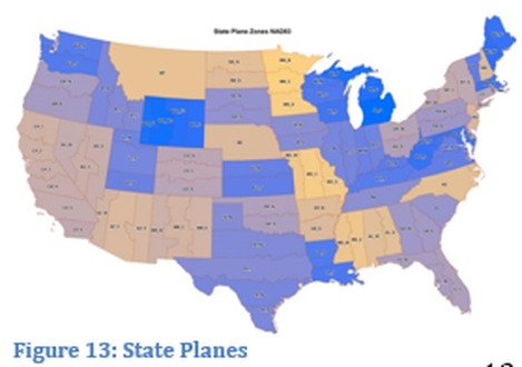
State Plane coordinate systems do not use latitude and longitude, only x and y positions on a Cartesian coordinate system measured in feet or meters. One of the more common coordinate systems used in an individual state, is the state plane. A state will adopt a specific coordinate system to use for state level maps. Some states have multiple state planes, depending on their geography. There are 124 state plane zones in the United States with 110 of those in the contiguous U.S.as seen in Figure 13
|
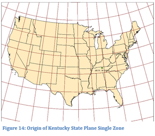
Most state planes are based on either transverse Mercator or a conic projection. A state plane is determined by setting an origin outside of the measured area. Measurements may be in feet or meters depending on the data source. Kentucky, for example, has a north and south state plane zone, but a single zone (1600) for most maps. The origin of the single zone is located at 36.33 N and 85.75 W which is also the origin of the South zone, see figure 14. Kentucky map positions are measured in both meters and feet.
UTM
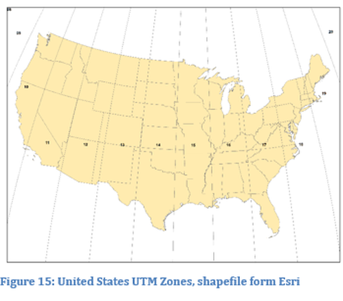
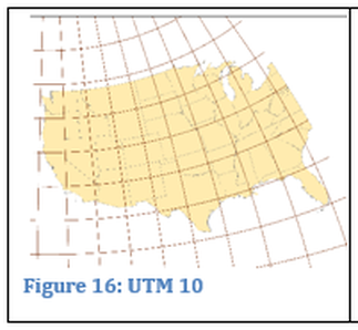
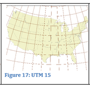
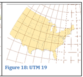
Universal Transverse Mercator (UTM) is another commonly used coordinate system. As the name indicates it uses a transverse Mercator projection. The earth is divided into 60, 6 degree zones and then further divided into a north zone and a south zone. Each of these zones would have a meridian that would be in contact with the projection cylinder. Zones 10 to 19 cover the contiguous United States from west to east. The farther east and west from the meridian the greater the distortion. The concept is consistent worldwide, but how the divisions are created varies with different geopolitical entities. The unit of measurement for UTM is meters, all measurements in a UTM are positive numbers, since the central line of longitude (meridian, x-value) is set at a value of 500,000 meters. East of the central meridian will create numbers less than 500,000 meters and west numbers greater than 500,000 meters. In the northern hemisphere the latitude (y-value) is set to zero at the equator and increases as you move north. For the southern hemisphere the value at the equator is set to 10,000,000 meters and decreases as you go south. Figures 16 to 18 display UTM projections of the United States in different zones.
|
|
|

