Introduction to Geodatabase
In this lesson, the learner will create and use a file/personal geodatabase. It is assumed that the user is familiar with the basic functionality of ArcCatalog and understands how to access files. ArcCatalog is specifically designed to work with ArcMap Desktop and can be accessed within ArcMap or as a standalone program.
A geodatabase, as its name implies, is a database designed specifically for use in a geographic map. There are two categories of geodatabases, relational (SQL, SQL Express, Oracle, etc.) and file/personal (non-relational). The file geodatabase, in many ways, functions in Microsoft Windows similarly to a compressed file folder containing shapefiles that must be stored together. The difference is the geodatabase user cannot directly view the contents outside of ArcMap or ArcCatalog. Thus from a windows environment it looks like a single file folder, but from an ArcGIS Desktop functionality it is a container holding multiple shapefiles.
A relational Geodatabase uses a product nonspecific to ArcGIS Desktop, but includes translators between the database and the map. One of the biggest differences between the file and relational database is that a file database only allows one user to access the data at a time, while the relational database allows multiple users to access and modify information at the same time. The relational database keeps track of the order in which modifications are made. In an Enterprise environment the designer’s organization would be utilizing relational databases placed behind a firewall. With a relational geodatabase, websites can be created that allow for modification and creation without the need for specific software. In addition field data collection can be done with a smart device. This course will use only file geodatabases.
File Geodatabase
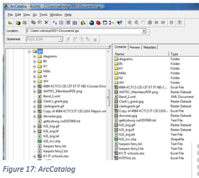
To create a file geodatabase you will need to open ArcCatalog, Figure 17 shows ArcCatalog prior to the creation of the geodatabase. In ArcCatalog right click on the folder where the geodatabase will be created and select new, once this selection has been made a prompt will request the type of geodatabase to create, which will be a File Geodatabase.
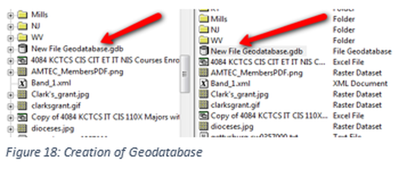
In Figure 18: Creation of Geodatabase the image shows the geodatabase that has been created but has not been provided a name so the default name is displayed (by the arrows).
Geodatabases are shown in ArcCatalog as a cylinder, which is a common method in other programs as well.
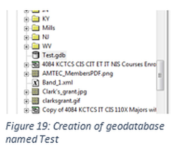
For this example the name of the geodatabase created will be Test. To change from the default name in Figure 18 to the name Test shown in Figure 19, select the database, right click on the database name and select rename.
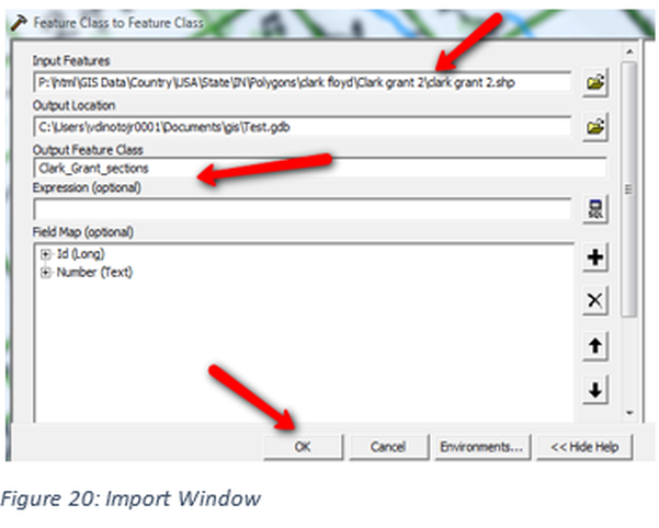
Once the geodatabase is created data needs to be placed within it. Right click on the geodatabase and then click on Import Using a Feature Class (single). Figure 20: Import Window the window used for importing a shapefile, a new file could have been created. In this process an existing shapefile is being placed within the geodatabase. The first box is used to locate the existing shapefile; in the third box a new name for the shapefile is to be specified. Note: the file name cannot have spaces contained within it, in this example the underscore is used instead of a space. The second box contains the location of the geodatabase which should be automatically inserted. Click ok and the process will begin.
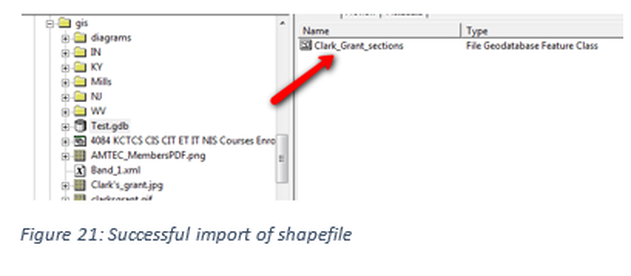
In ArcCatalog the imported shapefile should appear in the geodatabase. See Figure 21, the Test.gdb is highlighted in the left window and the contents are shown in the right window. Since this is a newly created geodatabase it contains only one file, but multiple shapefiles can be inserted individually or as a batch. The symbol has been changed to denote that it is contained within a geodatabase and not within a file folder. The original file has not been moved in this process and is still located at the same location.
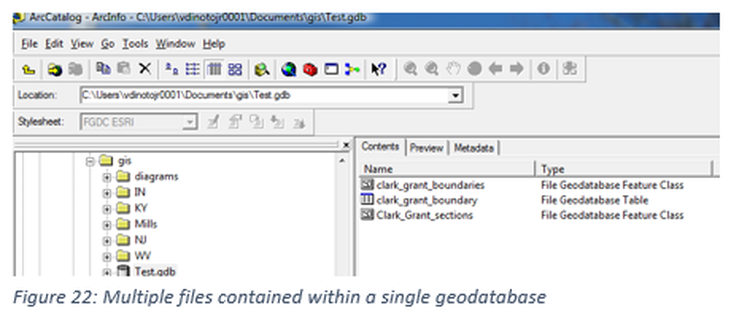
Repeat the process by adding another shapefile to the geodatabase. Figure 22: Multiple files contained within a single geodatabase, displays multiple files in the geodatabase with two being shapefiles and one a table. Note the symbols next to each file. These files were added by the same process as the first shapefile within the geodatabase. You may not simply drag and drop files into the geodatabase since the file structure must be modified. The database can hold in addition to shapefiles, images and tables.

